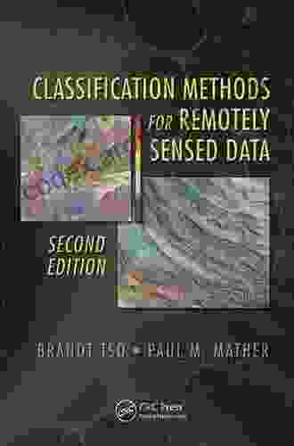
Unlocking the Secrets of Remotely Sensed Data: A Comprehensive Guide to Classification Methods

In today's data-driven age, remote sensing technology has become an indispensable tool for gathering valuable information about the Earth's surface and its ever-changing dynamics. One crucial aspect of remote sensing data analysis is the classification of data into meaningful categories or classes. This article delves into the diverse methodologies for classifying remotely sensed data, providing a comprehensive guide to help you choose the most appropriate technique for your research or application.
Remote sensing data classification plays a pivotal role in unlocking the full potential of vast amounts of data collected from satellites, aerial platforms, and other remote sensing systems. By categorizing data into distinct classes, such as land cover types, vegetation indices, or urban features, researchers and analysts can derive meaningful insights and make informed decisions.
Classification methods enable us to:
- Identify and map different land cover classes, such as forests, croplands, urban areas, and water bodies.
- Monitor and assess changes in land use and land cover over time.
- Quantify the abundance and distribution of vegetation, including biomass, leaf area index, and canopy cover.
- Classify urban areas into various land use categories, such as residential, commercial, industrial, and transportation.
- Extract features from remote sensing data, such as roads, buildings, and other man-made structures.
The wide range of classification methods available can be broadly categorized into two main approaches: supervised and unsupervised classification. Each approach has its own advantages and limitations, and the choice of method depends on the specific objectives of the study, the nature of the data, and the availability of training samples.
Supervised classification involves training a classifier using a set of labeled samples or training data. The classifier learns the relationship between the input data and the known class labels. Once trained, the classifier can be applied to classify new, unlabeled data into the predefined classes.
Pros:
- High accuracy when sufficient and representative training data is available.
- Allows for the definition of specific classes of interest.
- Suitable for complex and detailed classification tasks.
Cons:
- Requires extensive manual effort to collect and label training samples.
- Can be biased if the training data is not representative of the entire dataset.
- May struggle to classify data with significant spectral variability or noise.
Unsupervised classification does not require labeled training data. Instead, it groups pixels together based on their spectral similarity or other characteristics without prior knowledge of the class labels. The resulting classes are determined by the algorithm itself.
Pros:
- No need for time-consuming and expensive data labeling.
- Useful for exploratory data analysis and identifying unknown or unexpected patterns.
- Can handle large datasets efficiently.
Cons:
- Lower accuracy compared to supervised classification.
- Class labels may not correspond to meaningful categories.
- Requires careful interpretation and validation of results.
Within the broad categories of supervised and unsupervised classification, numerous specific algorithms have been developed for classifying remotely sensed data. Here are some of the most widely used and effective methods:
- Maximum Likelihood Classifier (MLC): A probabilistic approach that assigns pixels to the class with the highest probability of belonging to that class.
- Support Vector Machines (SVMs): A non-parametric algorithm that finds the optimal separating hyperplane between different classes in a high-dimensional feature space.
- Random Forest (RF): An ensemble method that combines multiple decision trees to improve classification accuracy and robustness.
- Convolutional Neural Networks (CNNs): Deep learning algorithms that have recently gained popularity for image and remote sensing data classification.
- k-Means Clustering: A simple and widely used algorithm that divides data into a user-specified number of clusters based on their spectral similarity.
- Fuzzy c-Means (FCM): A variant of k-Means that allows pixels to belong to multiple classes with varying degrees of membership.
- Hierarchical Clustering: A bottom-up approach that gradually merges similar clusters until a desired number of classes is achieved.
- Spectral Clustering: A graph-based algorithm that groups pixels based on their spectral similarity and spatial connectivity.
Choosing the most appropriate classification method for your research or application requires careful consideration of the following factors:
- Objective of the study: Are you interested in identifying specific land cover classes, quantifying vegetation parameters, or extracting urban features?
- Nature of the data: Is the data high-resolution imagery, multispectral data, or hyperspectral data? Are there any spectral or spatial patterns that can be exploited?
- Availability of training samples: Do you have access to labeled training data or do you need to use unsupervised methods?
- Accuracy requirements: How critical is it to achieve high classification accuracy?
- Computational resources: Consider the time and hardware requirements of different classification algorithms.
Classification methods are essential tools for unlocking the wealth of information contained within remotely sensed data. By choosing the most appropriate method for your specific research or application, you can extract meaningful insights and make informed decisions. The comprehensive overview provided in this article equips you with the knowledge and understanding to navigate the diverse landscape of classification techniques and harness the full potential of remote sensing data.
Do you want to contribute by writing guest posts on this blog?
Please contact us and send us a resume of previous articles that you have written.
 Book
Book Novel
Novel Page
Page Chapter
 Text
Text Story
Story Genre
Genre Reader
 Library
 Paperback
 E-book
 Magazine
 Newspaper
 Paragraph
 Sentence
 Bookmark
 Shelf
Shelf Glossary
 Bibliography
 Foreword
 Preface
 Synopsis
 Annotation
 Footnote
 Manuscript
 Scroll
 Codex
Codex Tome
Tome Bestseller
 Classics
 Library card
 Narrative
 Biography
 Autobiography
 Memoir
 Reference
 Encyclopedia
 George W Burns
 Brandon Cooper
 Lasting Happiness
 Bob Rives
 Bhikkhu Kakmuk
 Brian Hall
 Brian Knight
 Brian Comerford
 Bill Harvey
 Bobby Cremins
 Jane Higdon
 Brandon Webb
 Jeanine Hull
 Bianca Saeed
 Bob Cornelissen
 Bill Press
 Bloompaths Diy
 Michele Trapani
 Bill Williams
 Ian Eshey
Light bulbAdvertise smarter! Our strategic ad space ensures maximum exposure. Reserve your spot today!

 Mikhail BulgakovUnveiling the Provocative Tapestry: Excess in Contemporary Feminist Textiles...
 Octavio PazUnveiling the Secrets of Hypopituitarism: A Comprehensive Guide to Diagnosis,...
 Rodney ParkerFollow ·9.6k
 Francisco CoxFollow ·4.8k
 Ezekiel CoxFollow ·14.6k
 Thomas PowellFollow ·17k
 Ernest HemingwayFollow ·14.9k
 Darrell PowellFollow ·2.3k
 Alex ReedFollow ·13k
 Matthew WardFollow ·6.3k

 Darnell Mitchell
The Most Comprehensive PCOS Diet Cookbook for a Healthier...
If you're one of the...

 Carson Blair
Israelijudaism: A Portrait of Cultural Revolution
In the aftermath of the Holocaust, the State...

 Isaac Mitchell
The Construction and Reconstruction of the Human Body: A...
The Intricate Construction...

 Kenzaburō Ōe
ITSM in the Outsourced World of IT: Unlocking Value and...
In today's rapidly...

 Israel Bell
Empowering the Greater Good: A Comprehensive Guide to...
In an era marked by growing societal...


